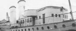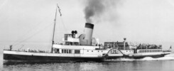
On Monday 24th December 1883, Christmas Eve, the Great Western Railway paddle steamer South of Ireland left Cherbourg during the evening for the run across the Channel bound for Weymouth.
It was a fairly calm night but there was fog about and this caused Captain Pearn to reduce speed. Shortly after midnight the fog lifted so full ahead was rung on the telegraph once again.
In his approach to Weymouth Captain Pearn would have been looking out for the lights and listening out for the foghorns from the then two lighthouses on Portland Bill, the lighthouse on Anvil Point four nautical miles east of St Albans Head and the Shambles Lightship which was moored at the eastern end of the Shambles Bank off Portland Bill. Today’s single lighthouse on Portland sends a white light out in groups of four flashes every 20 seconds and shines over a distance of 25 nautical miles. Anvil Point flashes white once every ten seconds and in clear visibility can be seen for up to 19 nautical miles. When it was withdrawn in 1971 and replaced by a buoy the Shambles flashed white in groups of two every thirty seconds with a visibility of eleven nautical miles.
A course of 335 degrees, with due allowance for the wind and tide, from Cherbourg should have taken Captain Pearn close to the east of the Shambles Lightship in a position five nautical miles east of Portland Bill. With the fog generally lifted he might reasonably have expected to see the lighthouses and the lightship flashing as he approached. If the fog had closed down he should have heard the foghorns in that position on both Portland Bill and on the Shambles Lightship.
However given his final course into Worbarrow Bay that night the tide must have set him further to the east than he had anticipated during his period steaming on half speed. This trajectory would have taken him a distance of 10 nautical miles east of Portland Bill and ten miles to the west of Anvil Point so in murky visibility at that distance on this night he might well not have seen any of these lights or heard any of their fog signals.
Back on the bridge put yourself in the position of the officer of the watch and/or the captain peering out into the gloom searching ahead for a glimmer of the lights you were expecting to see on yet another crossing on a route you have travelled often. You know that you should see the lights on Portland Bill, the Shambles Lightship and Anvil Point long before you are coming into any danger. You believe that the fog has lifted so you expect to see these lights, Portland Bill and the Shambles especially. You keep looking out for them. They don’t come up but you still feel sort of safe as you know that there is no danger out there until you have passed them.
What you don’t know is that you have now passed them unseen in the poor visibility ten miles east of where you thought you were. And therein lies the rub.
You keep peering out maybe by now getting a tad anxious as you have run your time over the journey distance. Why are they not coming up? You check the compass. Yes that’s OK. Still on 335 degrees. They must show soon.
Then suddenly the lookout shouts down “Dark object dead ahead, Sir”. You grab the telegraph and ring full astern but before you can stop the ship you have piled onto rocks in Worbarrow Bay just over one nautical mile east of Lulworth Cove and about nine nautical miles east of Weymouth. Oh dear.
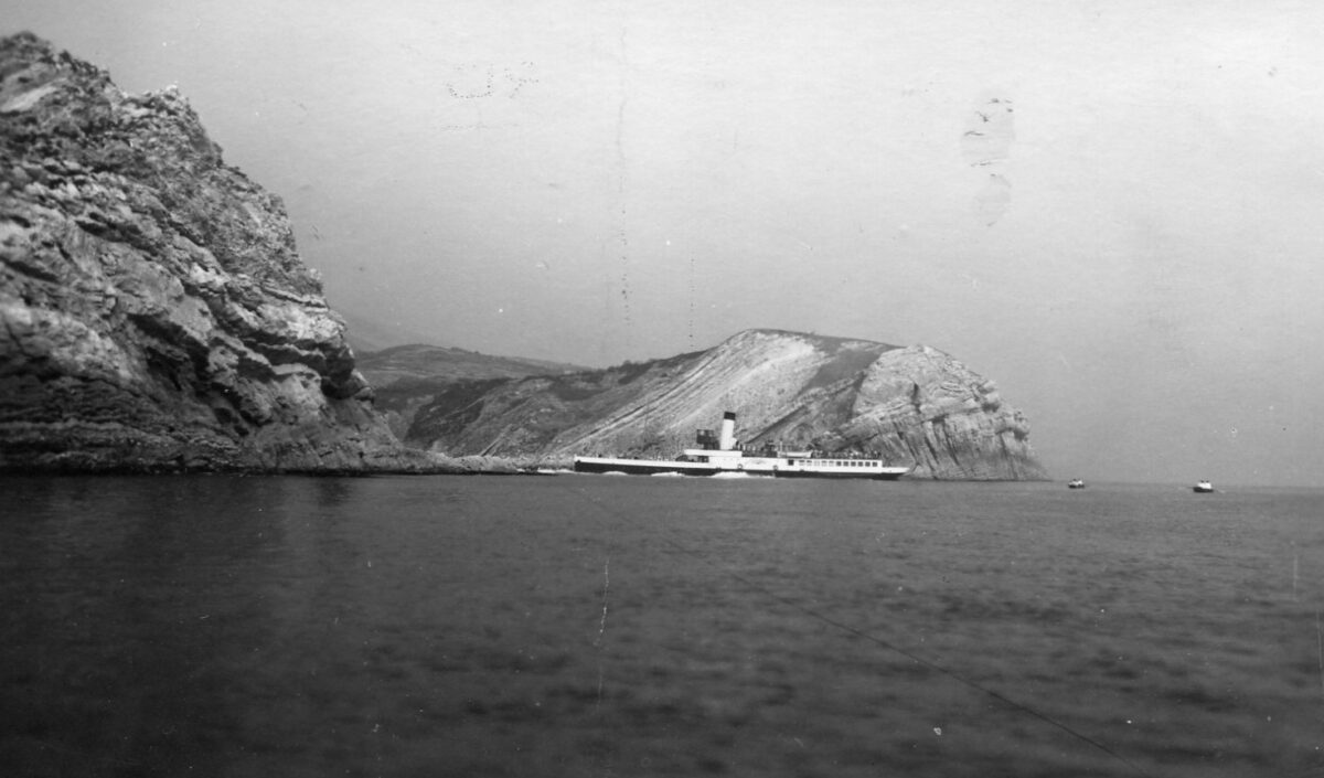
This is a particularly dark piece of coast at night devoid as it is of any towns, villages or even solitary houses to show any sort of light over pretty much the whole 15 nautical mile shoreline between Weymouth and St Albans Head. And anyone with any experience of looking out into total darkness will know just how dark real darkness is.
So what to do now? Remember this is long before ships had radios. There you are stuck on rocks in a particularly dark part of the coast with no human habitation overlooking or near you. How do you summon help?
Simple. A boat was lowered into the water with five of the crew in it plus the one passenger unlucky enough to have booked a passage on this night. They rowed along the shoreline to Weymouth which was reached four hours later at about 6am where the alarum was raised.
The following day the company’s marine superintendent Captain Lecky sent fleet running mate Aquila from Weymouth to assess the situation and take off the rest of the crew. She was followed after lunch by Cosens’s Prince with her eyes fixed firmly on salvage. In subsequent days much of the ship’s cargo and other portable property was taken off and brought back to Weymouth.
One question Captain Pearn was asked at the inquiry was to whether or not he had been taking soundings with his lead line. For any who don’t know a lead line is a piece of rope with various markings attached throughout its length. When thrown ahead of the ship moving through the water the weight on its end reaches the bottom and the seaman can then read off from the rope the depth of water by interpreting the markings on its length. The weight also has a hole in its end filled with tallow to which some of the bottom may be brought back up which can aid in identifying the ship’s position. Charts are marked not only with the depths but also the sort of material on the bottom at any given place. For example it might be clay, sand, shingle, weed, rocks, or whatever. That sort of thing.
The depth in the middle of the English Channel on a course of 335 degrees between Cherbourg and Weymouth is between 50 and 70 metres at chart datum. About ten miles SE of Portland Bill is the 40-metre line. From Portland Bill across to St Albans Head is roughly speaking the 30-metre line. Further north than that towards the shore it is around the 20-metre mark except over the Lulworth Banks, which extend from White Nothe to Lulworth Cove, on which it drops down to about 14 metres. East of the Lulworth Banks the 20m line extends to within one nautical mile from the shore. Captain Pearn reported that he had not been using the lead line.
In his defence one might argue that even if he had been using the lead line that night that might not have saved him. His approach to the Dorset Coast to the east of where he was expecting himself to be put him in deeper water than if had he come in over the Lulworth Banks which would have showed up more clearly on his lead-line, if he had been using it, that the water was getting shallower and that it would therefore be prudent to slow down. But he came in on trajectory right up to Worbarrow Bay where the water is 20m deep to within one nautical mile of the shore. And a mile isn’t very far for a ship travelling at 12 knots. That distance would have been covered in about five minutes. And if the lead line had been thrown every five minutes then the last reading could still have been 20m when the ship crashed.
The inquiry also asked Captain Pearn if he was using the ship’s log. For any who don’t know ships carry two sorts of logs. One of these is a hand written record of the voyage. The other is a piece of rope with a propeller attached to one end of it which is towed from the stern. As the ship moves through the water the propeller rotates. The rope rotates with it. And this turns dials on its attachment on the stern of the ship from which the distance travelled through the water can be read off.
The distance between Cherbourg and the Shambles Lightship is 60 nautical miles so if Captain Pearn had been using the log he should have slowed down when it clocked up sixty nautical miles on its dials if at that point he couldn’t see any of the expected lights. In my view, he should then have taken soundings and if in any doubt as to his position then gone to anchor to await better visibility at dawn. Captain Pearn reported that he had not been using the log.
It was therefore on the basis that he had not been using either the lead line or the log that the nautical assessors put the blame for the accident squarely on Captain Pearn and suspended his master’s ticket for three months. His employers then sacked him.
Attempts to salvage South of Ireland were made on 2nd January.
Kingswear Castle returned to service in 2026 after the second part of a major rebuild which is designed to set her up for the next 25 years. The Paddle Steamer Kingswear Castle Trust is now fund raising for future rebuilds. You can read more and how you can possibly help here.
John Megoran
This article was first published on 24th December 2020.